
California's Only Fly Fishing Report
Thats Updated Weekly

Scan here to view fishing report on phone


IF VIEWING ON PHONE, SCROLL DOWN TO THE BOTTOM

ITS FREE

FISHING REPORT
Updated - 7/12/26
Scroll below to see up to the minute Stream Flows,
Lodging, Map and Hatch Chart
Current River Conditions: Pit #3/350 CFS, Pit #5/449 CFS
Fishing Report-Good:
The Fly Shop in ReddingTM https://www.theflyshop.com reports that: "No recent firsthand reports from the Pit last week, the river will definitely warm up and you will see fish moving towards the cold seeps/creek inlets. Keep your eyes peeled for hatches, this time of year you can see stoneflies, PMDs and Callibaetis along with some big caddis. Good flies are always Perdigons, Hotspots, Rubberlegs, and don't discount a well-fished crayfish pattern. Some people fish Woolly Buggers, TJ Hookers can be very effective. Come on up and fish, the river is in!."
Be aware that the flows on the Pit can and will change without notice, so definitely check before you go! And be prepared to get out when the river begins to rise."
LODGING NEAR
Pit River
LOCAL FLY SHOPS
Up to the minute
Water Flows
Pit #3
Pit #5
Fishing Regulations
Home
EASTERN SIERRA
Truckee River
Little Truckee River
West Carson River
East Carson River
West Walker River
East Walker River
Upper Owens River
Lower Owens River
Hot Creek
Crowley Lake
Pyramid Lake
WEST SLOPE NORTHERN SIERRA
Upper Sacramento River
McCloud River
Hat Creek
Fall River
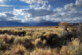
Pit River
Almanor Lake
North Yuba River
Baum Lake
STILLWATERS
BAY AREA
VALLEY
TAIL WATERS
Lower Sacramento River
Feather River
Lower Yuba River
Lower American River
Lower Mokelumne River
Putah Creek
NORTH COAST
Trinity River
Klamath River
Russian River
HATCH CHART - PIT RIVER
Pit River
About the Pit River
The Pit River begins near the town of Alturas, CA which is about 90 mi east of Burney. Once it reaches the town of Fall River Mills its gradient increases as it descends the west slope towards its terminus at Lake Shasta.
Along the way it (with Hat Creek) empties into Lake Britton near Burney. Below Lake Britton are several diversions and powerhouses operated by PG&E. The damed sections are known as Pit #3 Dam (at Lake Briton), Pit #4, Pit #5, Pit #6 and Pit #7. Pit’s #3 through #5 are the popular fishing sections.
The consistent flow of cool water is the perfect environment for aquatic life and of course the fish. Since that time, the population of warm water fish has diminished and the Rainbow population exploded.
Pit #3 section has become legendary, not only for the large fish that grow there but also for the difficulty of negotiating the boulders and swift water that runs through its deep canyon. For many young fly fishers a fishing excursion to Pit #3 has become a right of passage.
The fishing is also good below Pit #4 and Pit #5, where the river’s gradient levels off considerably into a broader flood plane. Even so, the boulders in the flood plane are so large and numerous that to get to the pockets required experience and advanced wading skills. Those who possessed such skills, are rewarded with days of great fishing for 12 to 15 inch fish that required the ultimate in skill to successfully be brought to the net in its swift water.
To reach Pit #3 from Burney, travel east on Hwy 299 for about 5 miles to its junction with Hwy 89, travel north Hwy 89 for about another 5 miles to Clark Creek Rd. Follow it until it crosses the Pit #3 dam and then turn southeast on Pit Canyon Rd which runs parallel to the river. The road begins relatively high above the river but after awhile it runs right along side of it for about three miles before it reaches the Pit #3 powerhouse.
Downstream of the Pit #3 powerhouse is the Pit #4 section. Part of the way, the road runs close to the river but eventually the road increases in elevation making it difficult to access the river. Once the road crosses the Pit #5 dam, you will come to the community of Big Bend. Of all the sections on the Pit, the Big Bend section has the easiest wading. There is intermittent access both upstream and downstream from Big Bend, but be aware that much of the riverside property is private.
The Pit isn’t everyone’s cup of tea but for the adventurous anglers it can be very rewarding. It should be on the bucket list of every young angler but if you wait too long in life to pay it a visit it will be too late.